
Tropical Storm Laura Could Become Major Hurricane
At a Glance

- Tropical Storm Laura is producing heavy rainfall in Cuba and the Cayman Islands.
- Laura will enter the Gulf of Mexico by early Tuesday.
- Conditions in the Gulf of Mexico could allow Laura to strengthen significantly.
- The intensity and track is still uncertain for when Laura approaches the U.S. Gulf Coast.
- However, there is an increasing major hurricane danger for parts of the Texas and Louisiana coasts by late Wednesday.
- Laura is also an inland flood risk as far north as Arkansas or southern Missouri.
Tropical Storm Laura could strengthen quickly into a major hurricane in the Gulf of Mexico with a dangerous threat of storm surge along parts of the Louisiana and Texas coasts, and threats of flooding rain and strong winds extending well inland later in the week.
Laura has prompted hurricane and storm surge watches for the Gulf Coast.
A hurricane watch has been posted from Port Bolivar, Texas, to west of Morgan City, Louisiana. This means hurricane conditions are possible within 48 hours in the watch area.
A storm surge watch has also been issued from San Luis Pass, Texas, to Ocean Springs, Mississippi. This watch, meaning life-threatening inundation of water moving ashore over land is possible within the area in 48 hours or less. The watch includes Galveston Bay, Lake Pontchartrain, Lake Maurepas and Lake Borgne for areas outside of the southeast Louisiana Hurricane and Storm Damage Risk Reduction System.
Tropical storm warnings continue from parts of Cuba into the Middle and Lower Florida Keys.
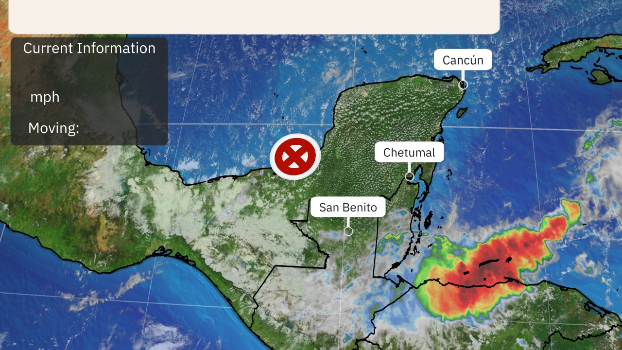
Laura is currently centered near the western tip of Cuba. Flooding rainfall and gusty winds will continue in parts of Cuba and the Cayman Islands into tonight. Some bands on the outer periphery of Laura's circulation have also rotated through the Florida Keys Monday.
A wind gust of 69 mph was measured in Key West, Florida, Monday afternoon as a line of showers associated with Laura moved through.
Laura will continue to track west-northwest through Tuesday with heavy rainfall and tropical-storm-force winds spreading along its path into Cuba and parts of the Florida Keys.
Rainfall totals of 4 to 6 inches are possible in western Jamaica, western Cuba and the Cayman Islands, with isolated totals of 10 inches. This heavy rain could lead to areas of flash flooding and mudslides in mountainous terrain of western Cuba.
Gusty winds from Laura could also cause tree damage and knock out power in some areas.
U.S. Hurricane Threat
The National Hurricane Center (NHC) forecast shows Laura's center will enter the Gulf of Mexico by early Tuesday morning, where intensification is forecast to begin.
It's possible Laura could undergo a brief period of rapid intensification according to the NHC. That means it could have a wind speed increase of at least 35 mph in 24 hours.
(IN DEPTH: Why Laura Could Join List of Recent Gulf Hurricanes That Rapidly Intensified)
Laura is then expected to make landfall somewhere along the Louisiana or Texas coast Wednesday night or early Thursday morning. Conditions are expected to deteriorate in these areas by Wednesday.
There may still be subtle, yet important changes to the track and intensity forecast over the next day or so.
For instance, any westward shift of the track could increase the threat of Laura's strongest winds, storm surge and rain in the Houston-Galveston metro area.
"Users are again reminded to not focus on the exact details of the track or intensity forecasts as the average NHC track error at 72 hours is around 100 miles and the average intensity error is around 15 mph," the NHC said early Monday morning.
The bottom line is that Laura is likely to bring storm surge, rainfall and wind impacts to parts of Texas and/or Louisiana Gulf Coasts beginning Wednesday. Keep in mind that a hurricane isn't just a point. Impacts will extend far from where the center eventually moves inland.
(MORE: Why the Projected Path For Hurricanes and Tropical Storms Doesn't Always Tell the Full Story)
Storm Surge Threat
The highest potential surge is expected along and to the immediate east of the center of Laura as it moves ashore Tuesday night or early Wednesday.
According to the National Hurricane Center, that could lead to inundation of 7 to 11 feet above ground level from High Island, Texas, to Morgan City, Louisiana, including Sabine Lake, Calcasieu Lake and Vermilion Bay, if it occurs at high tide.
See the map below for other storm surge peak inundation forecasts from the NHC.
Heavy Rain Threat
Laura could also spread rain and wind impacts far inland through parts of the lower Mississippi Valley and Ohio Valley late this week.
The NHC forecast indicates that 4 to 8 inches of rainfall, with maximum amounts of 12 inches, is possible from portions of the west-central U.S. Gulf Coast to the lower Mississippi Valley during the second half of this week, with the potential for flash flooding to extend well inland.
Wind
Tropical storm conditions are expected to spread westward within the warning area in western Cuba through Monday evening and into the middle and lower Florida Keys and Dry Tortugas Monday night.
Tropical storm conditions are possible along parts of the Gulf Coast by Wednesday afternoon, with hurricane conditions possible in the hurricane watch area by late Wednesday.
Waves
Larger swells generated by Laura could begin to arrive along the northern Gulf Coast as soon as later Tuesday and will continue to increase and spread west. These will likely be accompanied by dangerous rip currents and coastal flooding, particularly at high tide, which is generally each morning.
All interests along the Texas and Louisiana coasts should monitor this forecast closely and make preparations for a possible hurricane strike. Check weather.com for updates.
Laura's History
Tropical Depression Thirteen formed in the Atlantic last Wednesday night and strengthened into Tropical Storm Laura on Friday morning.
Laura is the earliest Atlantic 'L' named storm on record. The previous record was Luis on Aug. 29, 1995, according to Phil Klotzbach, tropical scientist at Colorado State University.
Laura brought heavy rainfall and gusty winds to the Leeward Islands and Puerto Rico later Friday through Saturday.
Southern parts of Puerto Rico picked up 2 to 6 inches of rainfall.


